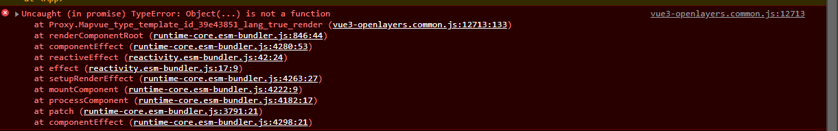
of course if I download the repository and build the app from scratch it works but importing the plugin in my existing project fails
<ol-view ref="view" :center="center" :rotation="rotation" :zoom="zoom" :projection="projection" />
<ol-swipe-control ref="swipeControl" v-if="layerList.length > 0" :layerList="layerList" />
<ol-layerswitcherimage-control />
<ol-tile-layer ref="osmLayer" title="OSM">
<ol-source-osm />
</ol-tile-layer>
<ol-tile-layer ref="jawgLayer" title ="JAWG">
<ol-source-xyz crossOrigin='anonymous' url="https://c.tile.jawg.io/jawg-dark/{z}/{x}/{y}.png?access-token=87PWIbRaZAGNmYDjlYsLkeTVJpQeCfl2Y61mcHopxXqSdxXExoTLEv7dwqBwSWuJ" />
</ol-tile-layer>
<ol-control-bar>
<ol-control-toggle html="<i class='fas fa-map-marker'></i>" className="edit" title="Point" :onToggle="(active)=>changeDrawType(active,'Point')" />
<ol-control-toggle html="<i class='fas fa-draw-polygon'></i>" className="edit" title="Polygon" :onToggle="(active)=>changeDrawType(active,'Polygon')" />
<ol-control-toggle html="<i class='fas fa-circle'></i>" className="edit" title="Circle" :onToggle="(active)=>changeDrawType(active,'Circle')" />
<ol-control-toggle html="<i class='fas fa-grip-lines'></i>" className="edit" title="LineString" :onToggle="(active)=>changeDrawType(active,'LineString')" />
<ol-control-videorecorder @stop="videoStopped">
</ol-control-videorecorder>
<ol-control-printdialog />
</ol-control-bar>
<ol-mouseposition-control />
<ol-fullscreen-control />
<ol-overviewmap-control>
<ol-tile-layer>
<ol-source-osm />
</ol-tile-layer>
</ol-overviewmap-control>
<ol-scaleline-control />
<ol-rotate-control />
<ol-zoom-control />
<ol-zoomslider-control />
<ol-zoomtoextent-control :extent="[23.906,42.812,46.934,34.597]" tipLabel="Fit to Turkey" />
<ol-context-menu :items="contextMenuItems" />
<ol-interaction-clusterselect @select="featureSelected" :pointRadius="20">
<ol-style>
<ol-style-stroke color="green" :width="5"></ol-style-stroke>
<ol-style-fill color="rgba(255,255,255,0.5)"></ol-style-fill>
<ol-style-icon :src="markerIcon" :scale="0.05"></ol-style-icon>
</ol-style>
</ol-interaction-clusterselect>
<ol-interaction-select @select="featureSelected" :condition="selectCondition" :filter="selectInteactionFilter" v-if="!drawEnable">
<ol-style>
<ol-style-stroke color="green" :width="10"></ol-style-stroke>
<ol-style-fill color="rgba(255,255,255,0.5)"></ol-style-fill>
<ol-style-icon :src="markerIcon" :scale="0.05"></ol-style-icon>
</ol-style>
</ol-interaction-select>
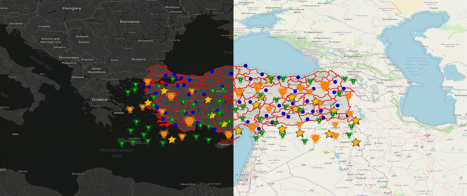
<ol-vector-layer title="AIRPORTS" :preview="require('../../../../public/img/map/tr.png')">
<ol-source-vector ref="cities" url="https://raw.githubusercontent.com/alpers/Turkey-Maps-GeoJSON/master/tr-cities-airports.json" :format="geoJson" :projection="projection" >
<ol-interaction-modify v-if="drawEnable" @modifyend="modifyend" @modifystart="modifystart">
</ol-interaction-modify>
<ol-interaction-draw v-if="drawEnable" :type="drawType" @drawend="drawend" @drawstart="drawstart">
</ol-interaction-draw>
<ol-interaction-snap v-if="drawEnable" />
</ol-source-vector>
<ol-style>
<ol-style-stroke color="red" :width="2"></ol-style-stroke>
<ol-style-fill color="rgba(255,255,255,0.1)"></ol-style-fill>
<ol-style-circle :radius="7">
<ol-style-fill color="blue"></ol-style-fill>
</ol-style-circle>
</ol-style>
</ol-vector-layer>
<ol-vector-layer :updateWhileAnimating="true" :updateWhileInteracting="true" title="STAR" :preview="require('../../../../public/img/map/star.png')">
<ol-source-vector ref="vectorsource">
<ol-animation-shake :duration="2000" :repeat="5">
<ol-feature v-for="index in 20" :key="index">
<ol-geom-point :coordinates="[getRandomInRange(24,45,3),getRandomInRange(35,41,3)]"></ol-geom-point>
<ol-style>
<ol-style-icon :src="starIcon" :scale="0.1"></ol-style-icon>
</ol-style>
</ol-feature>
</ol-animation-shake>
</ol-source-vector>
</ol-vector-layer>
<ol-animated-clusterlayer :animationDuration="500" :distance="40" title="CLUSTER" :preview="require('../../../../public/img/map/cluster.png')">
<ol-source-vector ref="vectorsource">
<ol-feature v-for="index in 500" :key="index">
<ol-geom-point :coordinates="[getRandomInRange(24,45,3),getRandomInRange(35,41,3)]"></ol-geom-point>
</ol-feature>
</ol-source-vector>
<ol-style :overrideStyleFunction="overrideStyleFunction">
<ol-style-stroke color="red" :width="2"></ol-style-stroke>
<ol-style-fill color="rgba(255,255,255,0.1)"></ol-style-fill>
<ol-style-circle :radius="20">
<ol-style-stroke color="black" :width="15" :lineDash="[]" lineCap="butt"></ol-style-stroke>
<ol-style-fill color="black"></ol-style-fill>
</ol-style-circle>
<ol-style-text>
<ol-style-fill color="white"></ol-style-fill>
</ol-style-text>
</ol-style>
</ol-animated-clusterlayer>
<ol-overlay :position="selectedCityPosition" v-if="selectedCityName !='' && !drawEnable">
<template v-slot="slotProps">
<div class="overlay-content">
{{selectedCityName}} {{slotProps}}
</div>
</template>
</ol-overlay>
<ol-vector-layer>
<ol-source-vector>
<ol-feature ref="animationPath">
<ol-geom-line-string :coordinates="path"></ol-geom-line-string>
<ol-style>
<ol-style-stroke color="red" width="7"></ol-style-stroke>
</ol-style>
</ol-feature>
<ol-animation-path v-if="animationPath" :path="animationPath.feature" :duration="4000" :repeat="10">
<ol-feature>
<ol-geom-point :coordinates="path[0]"></ol-geom-point>
<ol-style>
<ol-style-circle :radius="10">
<ol-style-fill color="blue"></ol-style-fill>
<ol-style-stroke color="blue" :width="2"></ol-style-stroke>
</ol-style-circle>
</ol-style>
</ol-feature>
</ol-animation-path>
</ol-source-vector>
</ol-vector-layer>
</ol-map>
</template>
<script>
import OpenLayersMap from 'vue3-openlayers'
import {ref, inject, onMounted} from 'vue'
import markerIcon from '../../../../public/img/map/marker.png'
import starIcon from '../../../../public/img/map/star.png'
export default {
setup() {
const center = ref([34, 39.13])
const projection = ref('EPSG:4326')
const zoom = ref(6)
const rotation = ref(0)
const format = inject('ol-format');
const geoJson = new format.GeoJSON();
const selectConditions = inject('ol-selectconditions')
const selectCondition = selectConditions.pointerMove;
const selectedCityName = ref('')
const selectedCityPosition = ref([])
const extent = inject('ol-extent');
const Feature = inject('ol-feature')
const Geom = inject('ol-geom')
const contextMenuItems = ref([])
const vectorsource = ref(null)
const view = ref(null);
const drawEnable = ref(false)
const drawType = ref("Point")
const changeDrawType = (active, draw) => {
drawEnable.value = active
drawType.value = draw
}
contextMenuItems.value = [{
text: 'Center map here',
classname: 'some-style-class', // add some CSS rules
callback: (val) => {
view.value.setCenter(val.coordinate)
} // `center` is your callback function
},
{
text: 'Add a Marker',
classname: 'some-style-class', // you can add this icon with a CSS class
// instead of `icon` property (see next line)
icon: markerIcon, // this can be relative or absolute
callback: (val) => {
console.log(val)
let feature = new Feature({
geometry: new Geom.Point(val.coordinate),
});
vectorsource.value.source.addFeature(feature)
}
},
'-' // this is a separator
]
const featureSelected = (event) => {
if (event.selected.length == 1) {
selectedCityPosition.value = extent.getCenter(event.selected[0].getGeometry().extent_)
selectedCityName.value = event.selected[0].values_.name;
} else {
selectedCityName.value = '';
}
}
const overrideStyleFunction = (feature, style) => {
let clusteredFeatures = feature.get('features');
let size = clusteredFeatures.length;
let color = size > 20 ? "192,0,0" : size > 8 ? "255,128,0" : "0,128,0";
var radius = Math.max(8, Math.min(size, 20));
let dash = 2 * Math.PI * radius / 6;
let calculatedDash = [0, dash, dash, dash, dash, dash, dash];
style.getImage().getStroke().setLineDash(dash);
style.getImage().getStroke().setColor("rgba(" + color + ",0.5)");
style.getImage().getStroke().setLineDash(calculatedDash);
style.getImage().getFill().setColor("rgba(" + color + ",1)");
style.getImage().setRadius(radius)
style.getText().setText(size.toString());
}
const selectInteactionFilter = (feature) => {
return feature.values_.name != undefined;
};
const getRandomInRange = (from, to, fixed) => {
return (Math.random() * (to - from) + from).toFixed(fixed) * 1;
}
const drawstart = (event) => {
console.log(event)
}
const drawend = (event) => {
console.log(event)
}
const modifystart = (event) => {
console.log(event)
}
const modifyend = (event) => {
console.log(event)
}
const swipeControl = ref(null)
const jawgLayer = ref(null)
const osmLayer = ref(null)
const layerList = ref([])
onMounted(() => {
layerList.value.push(jawgLayer.value.tileLayer);
layerList.value.push(osmLayer.value.tileLayer);
console.log(layerList.value)
});
const path = ref([
[
25.6064453125,
44.73302734375001
],
[
27.759765625,
44.75500000000001
],
[
28.287109375,
43.32677734375001
],
[
30.55029296875,
46.40294921875001
],
[
31.69287109375,
43.04113281250001
]
])
const animationPath = ref(null);
return {
center,
projection,
zoom,
rotation,
geoJson,
featureSelected,
selectCondition,
selectedCityName,
selectedCityPosition,
markerIcon,
overrideStyleFunction,
getRandomInRange,
contextMenuItems,
vectorsource,
view,
selectInteactionFilter,
drawstart,
drawend,
modifystart,
modifyend,
drawEnable,
drawType,
layerList,
jawgLayer,
swipeControl,
osmLayer,
starIcon,
changeDrawType,
path,
animationPath,
OpenLayersMap
}
},
}
</script>