county-of-simcoe-gis / simcoecountywebviewer Goto Github PK
View Code? Open in Web Editor NEWWeb Map Viewer built with React and OpenLayers. Built for GeoServer and ArcGIS Server.
License: MIT License
Web Map Viewer built with React and OpenLayers. Built for GeoServer and ArcGIS Server.
License: MIT License

![dependabot[bot] avatar](https://avatars.githubusercontent.com/in/29110?v=4 "dependabot[bot]")


Hi
I noticed that there is an issue with the List view and Group View after adding data by using the Add Data tool.
Suppose I am currently under Group View, and I open up the Add Data tool and then upload an KML file. A layer will be created and will be added to the group that is specified in the Add Data tool. After that, if I switched to List View, the layer that I just added disappear, and I cannot find it in either All Layers or the group that I added this layer. As the following screenshots show (first two images are in Group View, and the last two are in List View):


When I switched back to the Group View, the added layer is still in there. The same situation happens when I added a layer in the situation that I am under List View, and the layer is not showing up in Group View. I am thinking that the state of layer changes is not synchronized for these two views
Thanks,
When a bridge project is clicked from the Road Construction Theme panel, the map zooms to 0,0.
When a road project is clicked from the Road Construction Theme panel, the map does not appear to do anything, and this error is thrown in the console:
Uncaught Error: Unknown Geometry Type react-dom.production.min.js:232
at T (turf.min.js:316)
at Object.le [as centroid] (turf.min.js:1900)
at Object.a.itemClick [as onClick] (ThemeDataList.jsx:75)
at onClick (InfoRow.jsx:37)
at Object. (react-dom.production.min.js:49)
at p (react-dom.production.min.js:69)
at react-dom.production.min.js:73
at C (react-dom.production.min.js:140)
at M (react-dom.production.min.js:168)
at O (react-dom.production.min.js:158)
This is affecting only rc1.2.x - Polygons added to my maps by identifying a polygons data layer doesn't allow user to change the fill-color or fill-transparency.
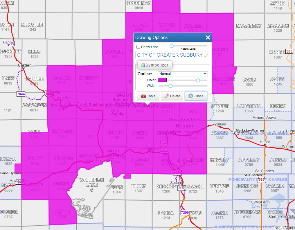
Increasing the Width bar to maximum under the outline removed the drawing temporarily from sight.
Broken link for no photo available on Real Estate property click
I am currently trying to set up the project locally and I am having a hard time configuring all the ports correctly. It would be really a great time saver I think if there would be a guide on how to stitch the together the components Viewer, API and Geoserver.
Tried turning on and displaying several layers in the Table of Contents - none of which exported to the final print job.
Conditions: Export to 11x8 JPG, symbolized circle, old 1997 aerial imagery.

I pushed the changes. The print works locally on my machine, but when pushed to opengis.simcoe.ca, the map keeps coming up blank. Check your network tab in dev tools and it seems to be missing all the Capabilities calls.
Originally posted by @iquitwow in #6 (comment)
I've tested this with all sorts of variables from Imagery to Topo, different page sizes, different exports, and different things buffered. Buffers don't seem to want to export at all, and I get the "print failed" message.

opengis.simcoe.ca: Basemaps options (under Topo ) are not clickable on iPhone 6s - Software version 13.3.1.
Failure to print given when adding a property polygon to display in map.

Hi,
When I open up the application with the link provided on the homepage, I added a layer from the "Services" by using the Add Data tool. The "Add to My Maps" button in the Reports tab is not working after I identifying a feature from that layer, and the app throws the following error. (It was an issue in the rc/1.2.x branch before, but since now the identify is not working for those layers added via Services in rc/1.2.x, I use the link provided on the home page to open the application, and also found this issues)
Uncaught TypeError: Cannot read property 'getType' of null

Thanks,
If a user has enabled a tool or theme and then collapsed the side panel and then attempts to use the link to that item under the "More...' button in the bottom left the panel does not slide back out and return them to their selection.
RC/1.2.x
Issues: With the recent changes.
1 - the popup identify (default left click) cycles all the layers regardless if they are turned on or off.
2 - Identify report (right click and pick from content menu) crashes the app.
When a TOC group which includes a layer with Disclaimer pop-up (such as Terrane parcel) is turned on all layer included in that group turn on without showing a pop-up for the restricted layer.
@Saspect-IO
Input:

Output Print:

Hi,
When I tried to identified a feature from the layers added through the "Services" tab in Add Data tool, and the application throws the error in the below screenshot when I tried to identify it. It was identifiable before.


By opening the URL, I can actually see the data obtained from the server, like below:

Thanks,
rc/2.1.x - When the Google map is triggered from the right mouse click context menu internal browser pops-up refuses to connect.

@Saspect-IO
Outputting coloured polygons on top of Aerial imagery results in:

I understand that my requirement is outside the purview of this project, but I need set up a webviewer and a GeoServer in a very short time period and I'm looking for plug and play options. Would it be possible to setup this project with a different Geoserver instance in order to display the layers in said server. Any help would be greatly appreciated. Even any suggestions on other open source plug and play options for a WebGIS. Thank You.
Steps to re-create the issue.
1- Load the map (https://opengis.simcoe.ca).
2- Search for School.
3- Click to the School (Popular Layers) – or you can search and click any other layer in a list other than All Layers.
4- Back to Search bar and search School again.
5- This time pick the School (All Layers).
6- Issue: -- TOC Scrolls to the bottom of the All Layers list and for 8-9 second doesn’t let you scroll up using scroll bar or Mouse.
rc/1.2.x
IDENTIFY_TITLE_COLUMN" keywords presented in GeoServer layers are ignored.
Adding layers to “Pre-Defined Maps (Groups)” from the "All layers" Group
If “Historical”, “Popular” and “Topo Overly” are pre-defined maps then allowing end-user to add layers from “All Layers" group (which is the list of all the available layers) to the pre-defined maps.
This change will allow more flexibility MAP configuration pattern for pre-defined maps while allowing "All Layers" group layers is parsed and created in the background since it will be used a list of all available layers which can be added to the per-configured maps. All Layers may not be needed as a pre-configured map???.
Add layer function can use the “Search Function” which will show only “All Layers” group content and when user clicks to the plus (+) beside the search dorp down this layer will be added to the active Map Configuration (Group).
Additionally an "Add Layer” button can be placed somewhere on the TOC which will get focus to Search drop down and extend it with layers listed when pressed.
Possible issue with the object in the DB config file.

Hi,
I encountered an issue of Failed to compile when I tried to run the application with npm start. Before running the code, I already ran npm install to install all the dependencies. Below is the versions of Node and NPM that I used.
node: v14.17.4
npm: 6.14.14
and below is the full description of the error:

If you also noticed this issue and have no a solution for it. A temporary solution to this problem is to modify the file ./node_modules/geotiff/src/geotiffimage.js by changing the code on the 4-th line from import { parse } from 'txml/txml'; to import { parse } from 'txml/dist/txml';

I am also not very sure about whether the problem is caused by the geotiff package or by any other thing. It would be great if the problem can be resolved.
Thanks,
When the Sidebar Object Merge is commented out:
Right moues click is still working while Draw and Measurement tools are in use. Right mouse button opens content menu and also works as left click.
Suggestion: Left click can be configured to cancel the current Drawing Tool action and the RED x can button can be removed from Draw tool bar.

@Saspect-IO
Placing point and line features and then increasing their size, as well as thickening their borders, does not export to print - they disappear in the final product. Also of note, the borders on dots that are not resized do not export either.

Forestry Theme does not export properly. Not all features show up and there is some sort of filter on it as well.

It seems as though the arrow drawing either doesn't allow exports to print, or when it does, it does not show up. I have tested this with PNG, PDF, and JPG outputs, with Topo/Imagery, with different settings for exports, and with different arrows. In most cases there is a print error, and in very few cases does the map actually export to something, and when it has, the arrow has not been present.

@Saspect-IO
Conditions: Two arrows drawn, on topo, tried to export to PDF.

All Layer group in Folder TOC is back. Is this intentionally brought back? If this is still a requirement for County of Simcoe should we make this a configurable item?

A declarative, efficient, and flexible JavaScript library for building user interfaces.
🖖 Vue.js is a progressive, incrementally-adoptable JavaScript framework for building UI on the web.
TypeScript is a superset of JavaScript that compiles to clean JavaScript output.
An Open Source Machine Learning Framework for Everyone
The Web framework for perfectionists with deadlines.
A PHP framework for web artisans
Bring data to life with SVG, Canvas and HTML. 📊📈🎉
JavaScript (JS) is a lightweight interpreted programming language with first-class functions.
Some thing interesting about web. New door for the world.
A server is a program made to process requests and deliver data to clients.
Machine learning is a way of modeling and interpreting data that allows a piece of software to respond intelligently.
Some thing interesting about visualization, use data art
Some thing interesting about game, make everyone happy.
We are working to build community through open source technology. NB: members must have two-factor auth.
Open source projects and samples from Microsoft.
Google ❤️ Open Source for everyone.
Alibaba Open Source for everyone
Data-Driven Documents codes.
China tencent open source team.


